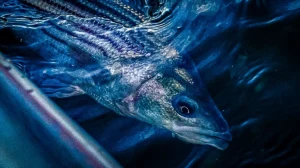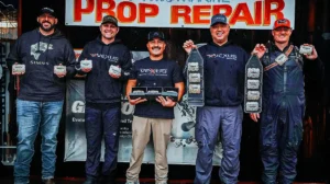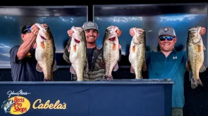


Green Bay is an arm of Lake Michigan, a top destination for giant springtime walleyes using casting techniques. Professional multi-species guide Doug Wegner breaks down how to find congregations of walleyes throughout the spring by understanding the bay itself. Whether targeting shallow flats in the west half of the bay for prespawn fish, or the steep break lines of the east bay a little later, Wegner’s guidance will help you get and stay on the fish.
DOUG’S BOAT SETUP
-
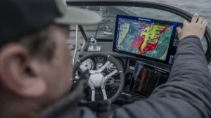
- MAPPING – Humminbird LakeMaster Premium VX Digital Map Chart Card Buy at Bass Pro Shops
- CONSOLE GRAPH – Humminbird SOLIX 15, replaced with Humminbird APEX 16 CHIRP MEGA SI+: Buy at Humminbird
- TROLLING MOTOR – Minn Kota Ulterra (Item # 1358503): Buy at Bass Pro Shops
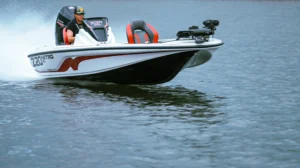
- BOAT – Lund 219 Pro-V GL: Check out at Lund Boats
- MOTOR – Mercury Verado 400hp 5.7L V10: Check out at Mercury Marine
GREEN BAY’S WEST SHORE: SHALLOW SPAWNING GROUNDS
The west shore of Green Bay warms fast due to its expansive shallow flats and multiple tributaries, making it a prime walleye spawning area in late March and April. Major tributaries like the Fox, Peshtigo, Oconto, and Menominee Rivers bring inflow, creating the perfect conditions for natural reproduction.
Key features of the west shore include:
- Large delta areas with extensive sand flats and marshlands
- Numerous inflows deliver warmer water and create oxygen-rich environments
- Mussel beds and gravel seams hold both staging and post-spawn walleyes
Many walleyes migrate from the east shore to these shallow flats in late March and early April, then return to deeper water and the east shoreline as the spring progresses.
EAST SHORE STRUCTURE: ROCKY SHARP BREAKS AND CLEAR WATER
Unlike the dingier water and expansive flats of the west shore, Green Bay’s east shore has steep near-shore breaks. These steep edges create ambush points for post-spawn walleyes chasing baitfish.
Features of the east shore:
- Fast-breaking rocky structures with and abundance of hard-bottom transitions
- Distinct transition zones between rock, rubble, and sand which creates distinct feeding zones
By using LakeMaster mapping and side imaging, Wegner pinpoints high-percentage areas based on depth, structure, and seasonal movements. Adjusting color shading for depth zones allows for quick decision-making when scanning water.
WHY LAKEMASTER MAPPING GIVES YOU AN EDGE
LakeMaster mapping simplifies Green Bay’s vast, complex fishery by offering:
- Custom depth shading for targeting specific depth ranges
- Waypoint marking to track productive spots
- Detailed bottom contours to locate transition zones
Whether fishing spring spawning flats along the west shore or the steep dropoffs of the east, Wegner’s time-tested Green Bay walleye location tips will help you quickly locate and stay on active fish.